An interactive decision-support tool that visualises the strategic use of daylight in river restoration.

Letting stakeholders co-design and reflect on restoration scenarios.

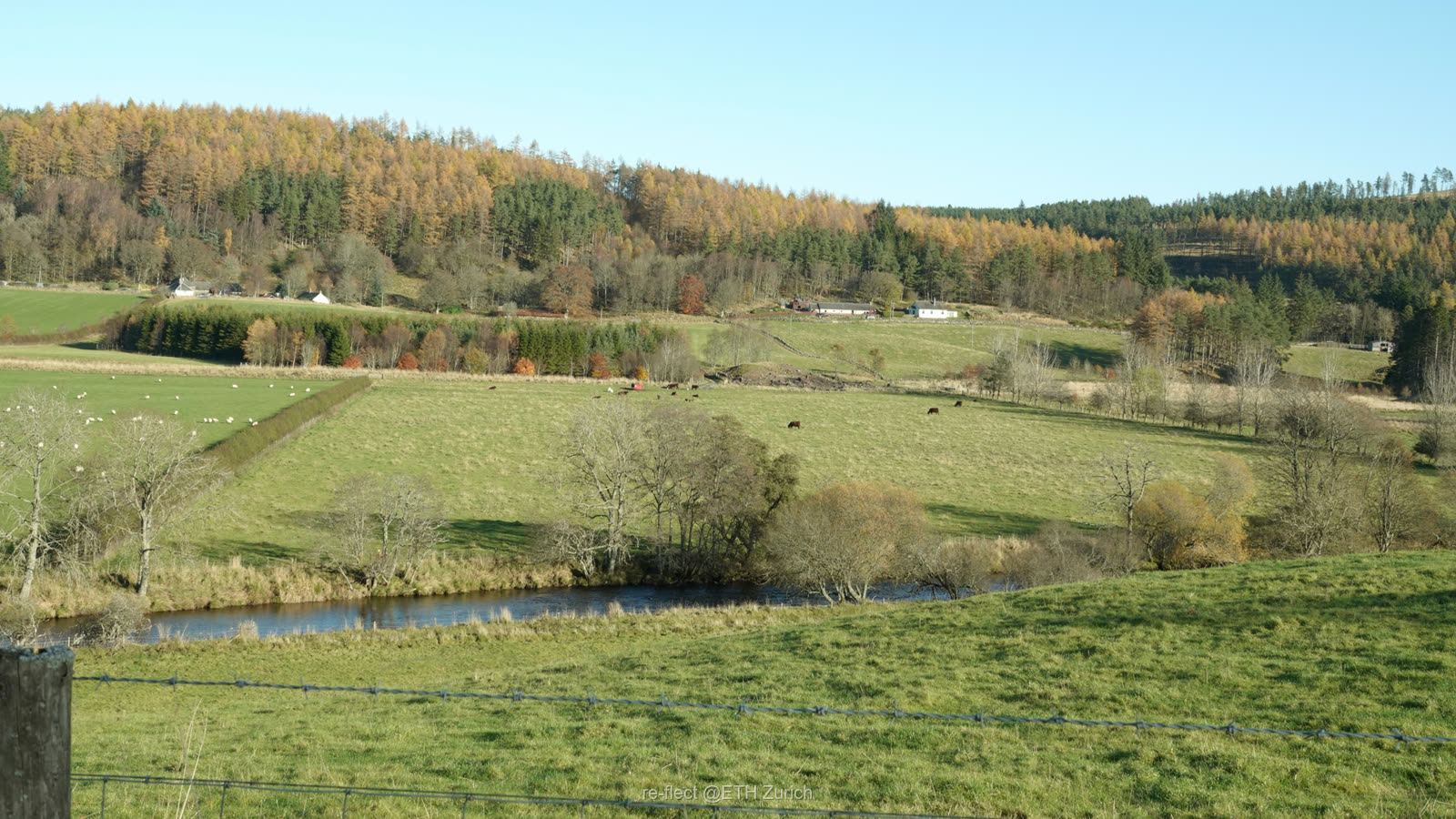
Rural · Scotland
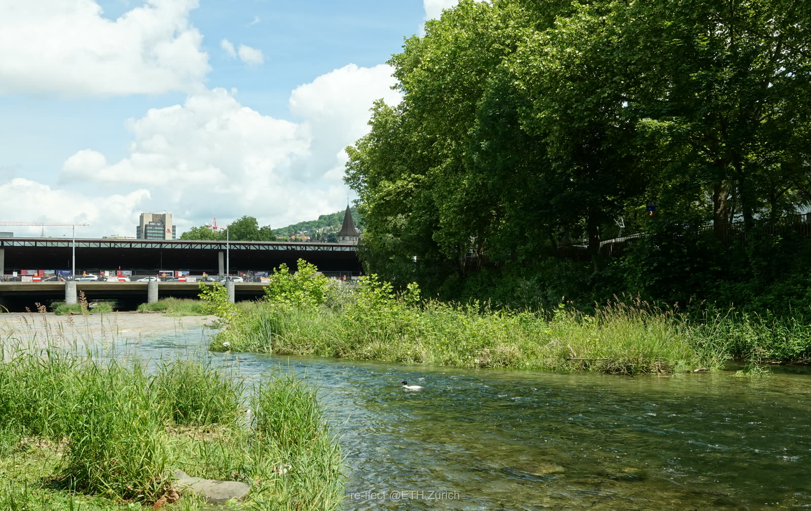
Urban · Zurich
01 The challenge

Two rivers, two extremes of light — and the same loss of life.

Restoration decisions are too often made without a shared picture of how light shapes a waterway. re•flect integrates geographic and ecological models with real-time visual feedback to simulate how planning decisions shape the landscape and its consequences.

Overexposed rural river Rural · Scotland

Overexposed to sunlight

Many Scottish rivers have lost their riparian woodlands, driving water temperatures up and threatening cold-water species.

≈2°Cpeak temperature drop from woodland within a 25 m buffer

Buried urban culvert Urban · Zurich

Buried in culverts

Dense development has driven waterways underground, severing habitats and disrupting ecological connectivity.

33%of Zurich's waterways run hidden beneath the city
02 The tool

Make environmental knowledge something everyone can see.

re•flect turns models into a living map. It couples geographic and ecological data with real-time visual feedback, so non-experts can explore how a decision ripples across the landscape — empowering stakeholders to participate meaningfully in ecosystem restoration.

First conceived as AI-generated imagery, re•flect grew into a fully interactive 3D tool built on a game engine — so stakeholders explore scenarios live, rather than viewing fixed pictures.

  • A Visualise restoration scenarios before a single tree is planted
  • B Incorporate diverse stakeholder perspectives
  • C Assess the costs and benefits of each option
  • D Support collaborative, transparent decision-making
Runs in your browser · invite code required
03 Strategic shading

Every tree counts. See exactly where each one cools the water.

By modelling vegetation and daylight regimes in three dimensions, re•flect reveals where shade delivers the greatest ecological return — turning "plant more trees" into a precise, place-based strategy.


  • 01 Opportunities & limits for stream daylight management
  • 02 Vegetation and daylight regimes in 3D
  • 03 Tools for visual, participatory scenario building
04 Our team

Ecologists, engineers and social scientists — one shared river.

05 Work packages & progress

The plan, and our progress.

Objective 1

Realistic scenarios

Develop realistic future scenarios for the fundamental changes in daylight availability that result from river restoration.

Objective 2

Test the effectiveness

Test the effectiveness that visualisations of these scenarios have on decision-makers' and stakeholders' support of river restoration.

Objective 3

An online tool

Develop an online visualisation tool to facilitate decision-making about daylight management in river restoration.

WP1
Completed

Opportunities and limits for stream daylight management

Completed through literature review, spatial analysis and socio-political assessment in rural Scotland and the City of Zurich — identifying the key opportunities and constraints for stream daylighting.

  • MS1 Maps for Scotland and Switzerland, showing and quantifying culverted streams and hot spots of lacking riparian woodlands.
  • MS2 Detailed analysis of obstacles for daylight management in river restoration to inform tool development and stakeholder implementation.
WP2
Completed

Vegetation and daylight regimes

Completed: vegetation-classification review, field assessment, spatial analysis and daylight modelling define a set of structurally distinct riparian habitat types that directly inform the visual restoration scenarios.

  • MS3 Set of visual vegetation and habitat scenarios, ready to be fed into the visualization tool.
WP3
On track

Tools for visual scenario building

Generative-AI tools were tested for scenario imagery; guided by WP1's user needs — longitudinal navigation and technical indicators — the tool shifted from 2D AI images to interactive 3D landscape visualisation (Unreal Engine), now being refined for stakeholder testing.

  • MS4 Prototype for AI-based visualization tool available online.

Completed  ·  In progress  ·  Upcoming

Explore the evidence by milestone
MS1Spatial analysis — culverted streams & missing riparian woodlandRural · Scotland →Urban · Zurich →
MS2Obstacles to daylight managementRural · Scotland release soonUrban · Zurich release soon
MS3Vegetation & habitat scenariosRural · Scotland release soonUrban · Zurich release soon
MS4Interactive visualisation tool prototypeRural · Scotland release soonUrban · Zurich release soon
MS5Manual & training programRural · Scotland release soonUrban · Zurich release soon
Publications
Student theses
01Above- and belowground structural diversity of woody plants along restored urban streams in winterJanne Henrike Maurer · Leibniz University Hannover · BSc · supervised by FK and XZ · Apr 2025WP2
02Riparian afforestation under two different implementation pathways: evidence from early vegetation development in the Tweed catchment, ScotlandSrdjan Strack · Leibniz University Hannover · MSc · supervised by FK and XZ · Jan 2026WP2
Conference presentations
Sustaining and Managing Ecosystem Services in Urban Wetlands for ALLIFLA 60th World Congress · Istanbul, Turkey · Sep 4–6, 2024 · Oral
XZ
Potential of Using Generative Artificial Intelligence for Participatory River RestorationETH Domain Conference: Social Sciences on Environment, Technology & Sustainability · Zurich · Jan 27, 2025 · Oral
XZ · FK · PB · JG · MB · AD
Developing an Ecology-Integrated Gaming Tool for Collaborative Landscape DesignDigital Landscape Architecture · Dessau, Germany · Jun 4–6, 2025 · Oral
XZ · AD · PB · MB · JG · FK
Fostering Participatory Urban River Restoration through an Ecologically-Integrated 3D Visualisation ToolIALE 2025 · Bratislava, Slovakia · Sep 2–5, 2025 · Oral
XZ · PB · AD · JG · MB · FK
Spatial Tools for Inclusive Ecosystem Restoration in Urbanizing Landscapes5th Int. Seminar on the Landscape & Ecology of the Yangtze River Economic Belt · Chongqing, China · Dec 20, 2025 · Oral
FK
Invited talks & organised events
Interactive Visualisation Tools for Participatory River RestorationSustainability Science Summit · DKN German Committee Future Earth, Berlin · Feb 21, 2025 · 30 participants
XZ · FK · PB · JG · MB · AD
Potential of Using Generative Artificial Intelligence for Participatory River RestorationSeminar · Institute of Environmental Planning, Leibniz Universität Hannover · Feb 18, 2025 · 20 participants
XZ · FK · PB · JG · MB · AD
From the Perception of Restored Wetlands to the Visualisation and Co-design of River RestorationSeminar · Chair of Planning of Landscape and Urban Systems, ETH Zurich · Oct 31, 2025 · 20 participants
XZ · FK · PB · JG · MB · AD
06 Get involved

The tool is better with your knowledge in it.

Share your restoration experience

If you've faced challenges in past river restoration projects, we'd love to hear about them in a 1–1.5 hour interview that shapes how the tool works.

Join an interview →

Join the advisory board

Strategic advisors engage with us regularly, gain early access to the visualisation tool, and are recognised in our publications.

Become an advisor →

Help us reflect a better river.

Empowering stakeholders to participate meaningfully in ecosystem restoration — one daylit stream at a time.